18 ANTXORITZ CLUBS
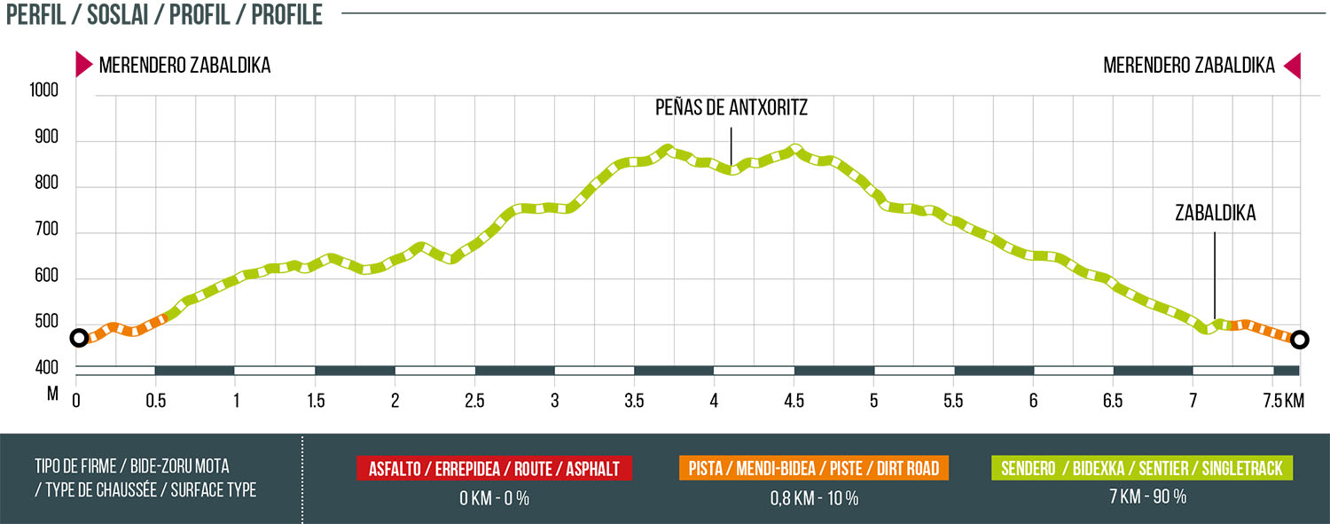
Distance
7.8 km
High
525 m
Downhill
525 m
TIme
2 – 2:30 h
Difficulty
Level

Wikiloc
Download trail
Track
Download track
Technical specs
Download file
Start
Olloki
Agua
Olloki

Track description
We will start from the Merendero de Zabaldika and ascend through the Xaixulo area towards the Alto de Elordi. From this mountain, we will descend towards the Collado de Zabalgain and continue along the northern ridge passing through Arromendi and reaching the Peñas de Antxoritz. When we reach the crags, we will face a grade II climb, so it is recommended to have the physical and technical capacity to face this step. To return, we will follow the outward path to a point where we will turn off onto a path that enters a beautiful pine forest that runs along the slope of Cara-Irotz, to go down and cross the Ezpeldi stream next to the village of Zabaldika. From there, we will return to the picnic area of Zabaldika by a path that borders the village.
Route map
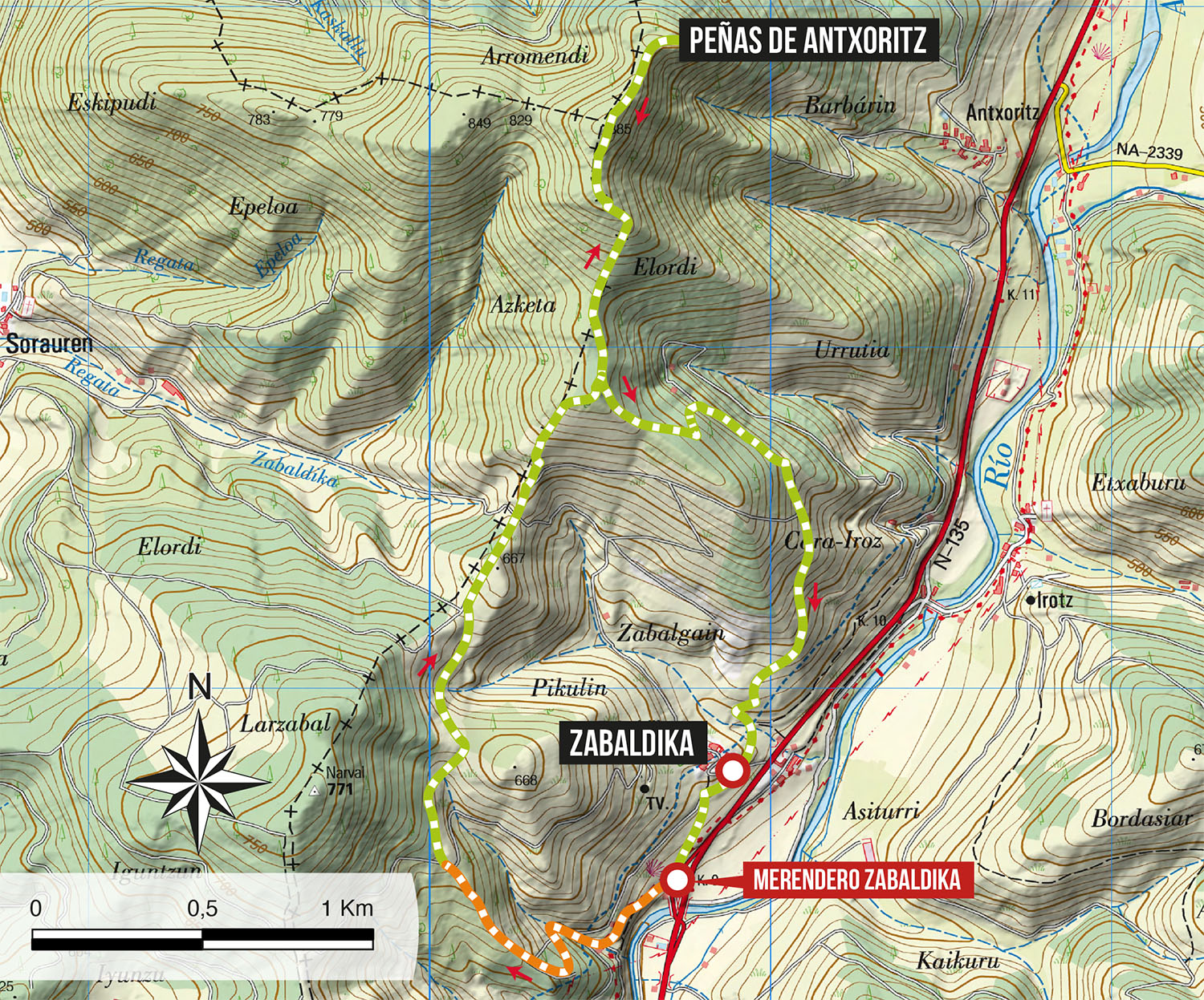
Profile