14 URKIAGA EUGI
Distance
14.3 km
High
400 m
Downhill
680 m
TIme
3 h
Distance
19.4 km
High
470 m
Downhill
710 m
TIme
2 h
Difficulty
Level

Wikiloc Hiking
Download trail
Track
Download track
Technical specs
Download file
Wikiloc MTB
Download trail
Track
Download track
Technical specs
Download file

14 URKIAGA EUGI
Start
Urkiaga, Eugi
Agua
Eugi
Track description
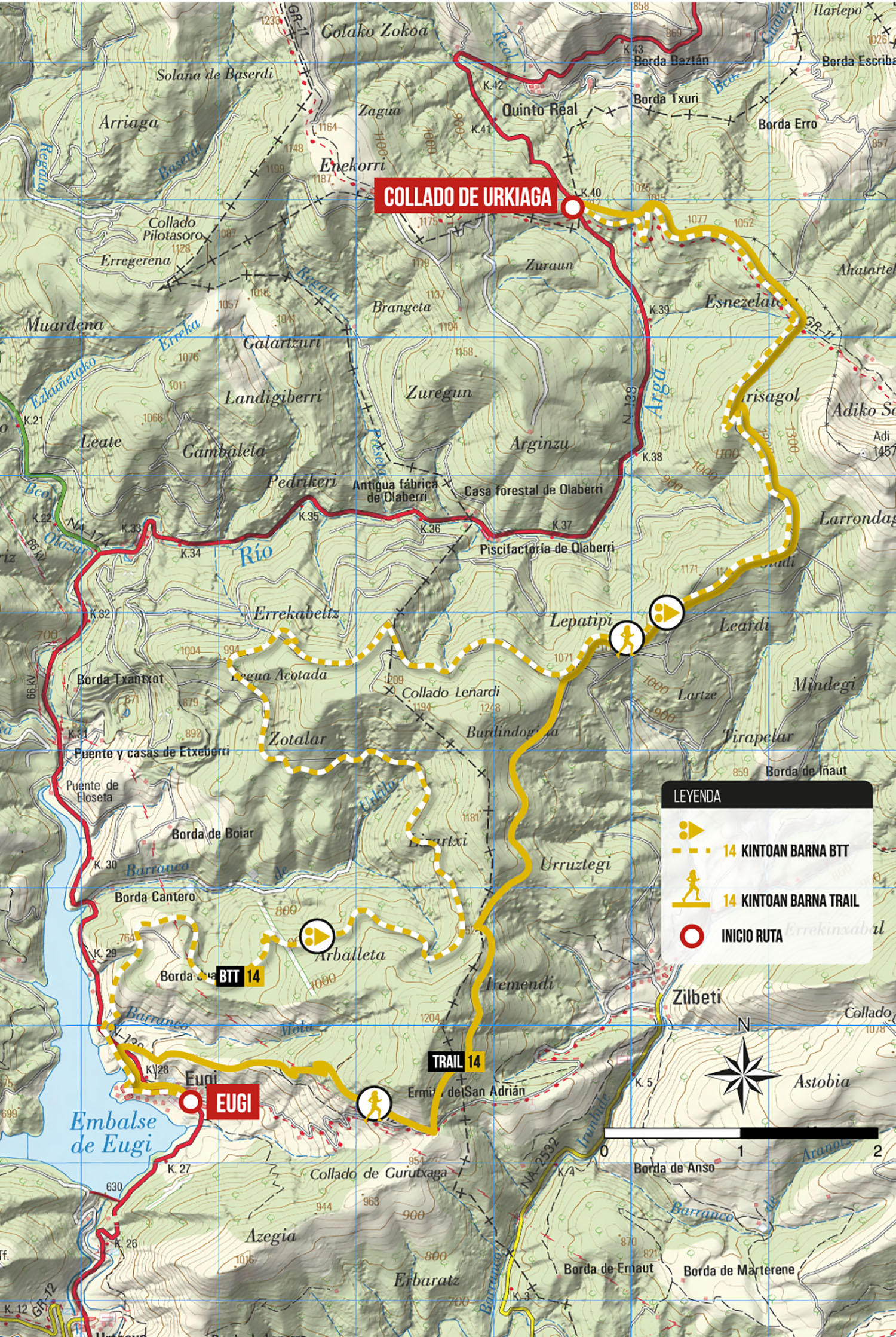
The route starts at the Urkiaga pass and has previously departed from Banca, passing through Alduides and Urepel. It starts through the GR-11 and GR-12 up to the Esnezalaieta crossroads. From there we will continue heading SOUTH until the route forks into a BTT variant and a hiking variant.
The BTT variant goes around the Zotalar and all the western slope of this hillside to then go down a comfortable track to the village of Eugi.
The hiking variant continues in a southerly direction, going around Zotalar on its eastern side along a beautiful path surrounded by beech trees until reaching the Gurutxaga pass. At this point, the path descends directly towards the village of Eugi.
Route map
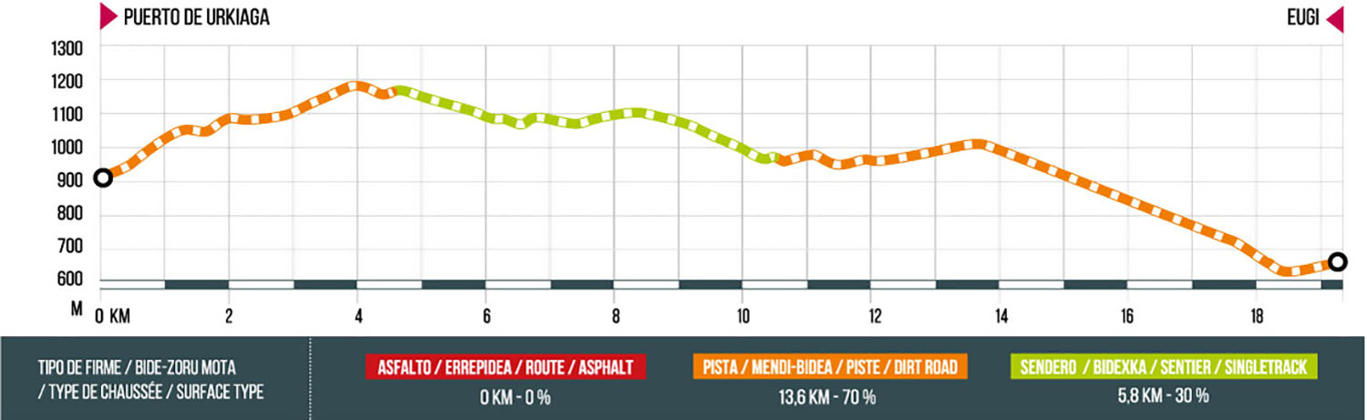
MTB route profile
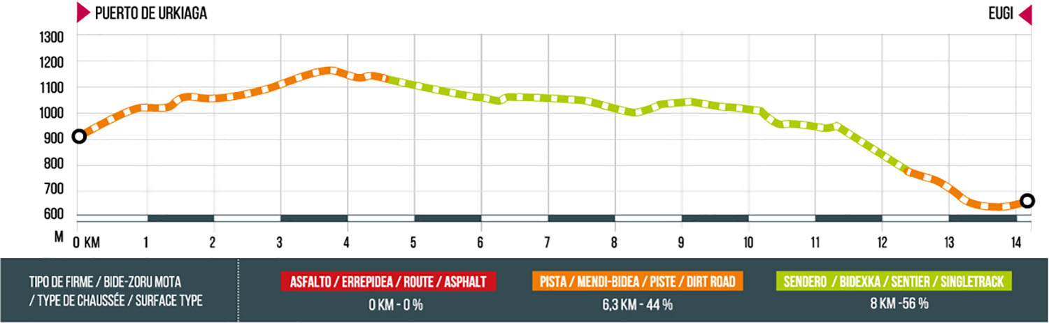
Trail route profile