13 NAFARROA EXTREM
Distance
70.2 km
High
4000 m
Downhill
–
TIme
10 – 14 h
Difficulty
Level

Wikiloc
Download trail
Track
Download track
Technical specs
Download file
Start
Zubiri
Agua
Zubiri, Saigots, Aritzu, Iragi and Usetxi

Track description
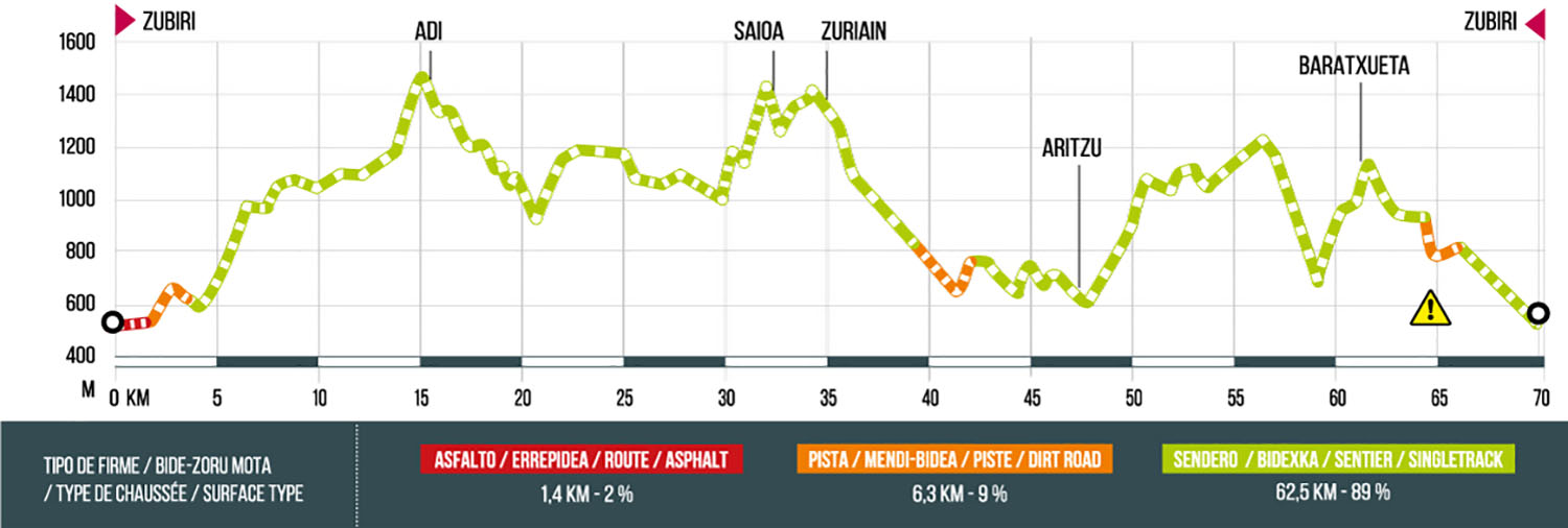
The route begins and ends in Zubiri and crosses beautiful beech forests such as Kinto Real, pastures or streams of the Arga basin. If you dare to take this route you can climb the emblematic peaks of the area such as: Adi, Saioa, Zuriain and Baratxueta, crossing ridges that separate the valleys of Erro, Esteribar, Baztan, Anue, and Lantz.
With a route of more than 70 km and 4000 meters of positive elevation gain, it is necessary to be in excellent physical shape.
If you are thinking of doing the route with the mtb, there are areas that require pushing the bike, especially on the peaks of the route.
Route map

Profile