11 REVIRED
Distance
8.7 km
High
260 m
Downhill
260 m
TIme
1 – 2 h
Difficulty
Level

Wikiloc
Download trail
Track
Download track
Technical specs
Download file

11 REVIRED
Start
Zubiri
Agua
Zubiri, Saigots
Track description
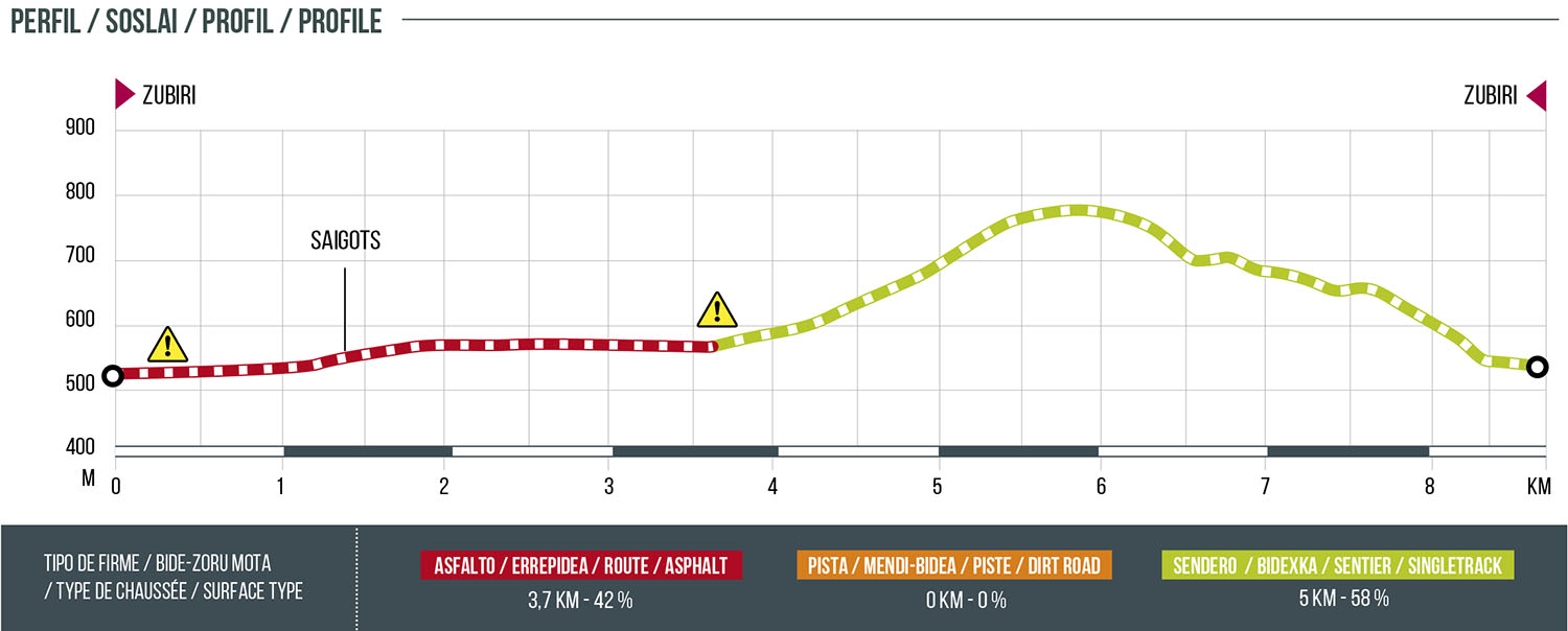
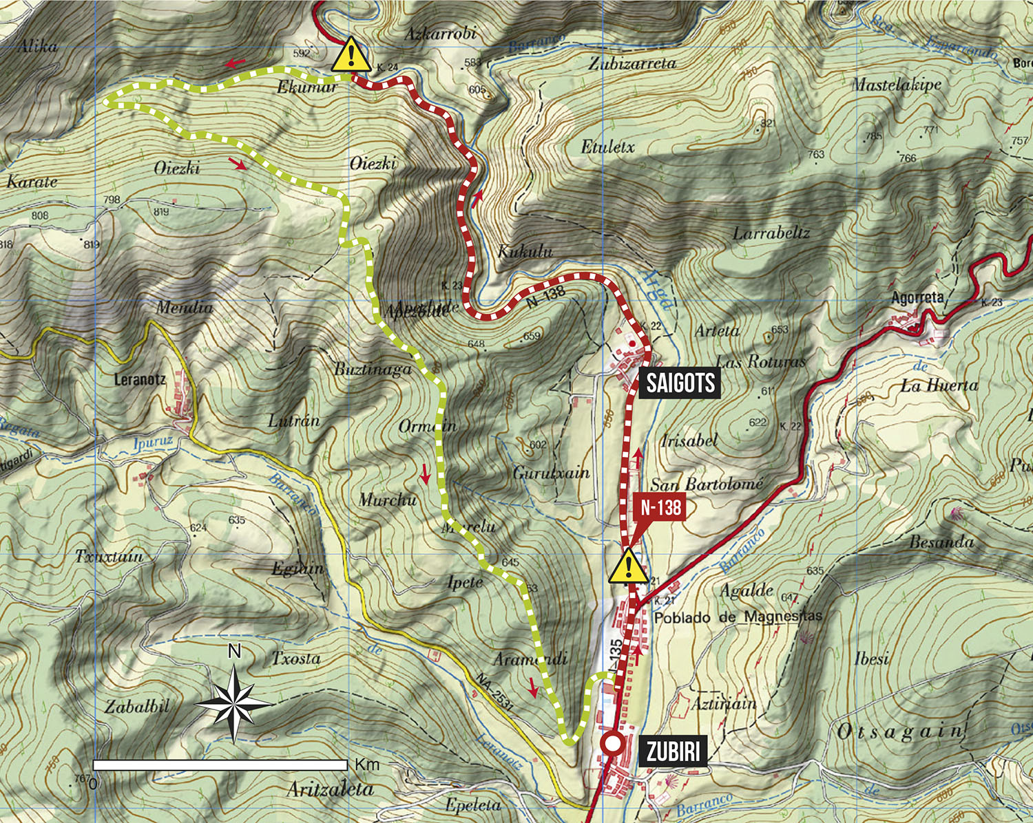
Starting from the Espacio BTT y TRAIL EREMUA in Zubiri, we will take a stretch of the NA-138 road until we turn off at the height of a white hut at km: 3.1. From there we will take a path that ascends to the slopes of the Oiezki mountain. In the mountain range, once the descent begins, there are stretches that coincide with the GR 225. Halfway down, their paths separate and our route will continue towards Zubiri along a path with some technical sections.
Route map
Profile