06 ERREGENERA TRAIL
Distance
6.8 km
High
–
Downhill
345 m
TIme
1-2 h
Difficulty
Level

Wikiloc
Download trail
Track
Download track
Technical specs
Download file

06 Erregerena
Start
Castañal de Eugi
Agua
Eugui
Route description
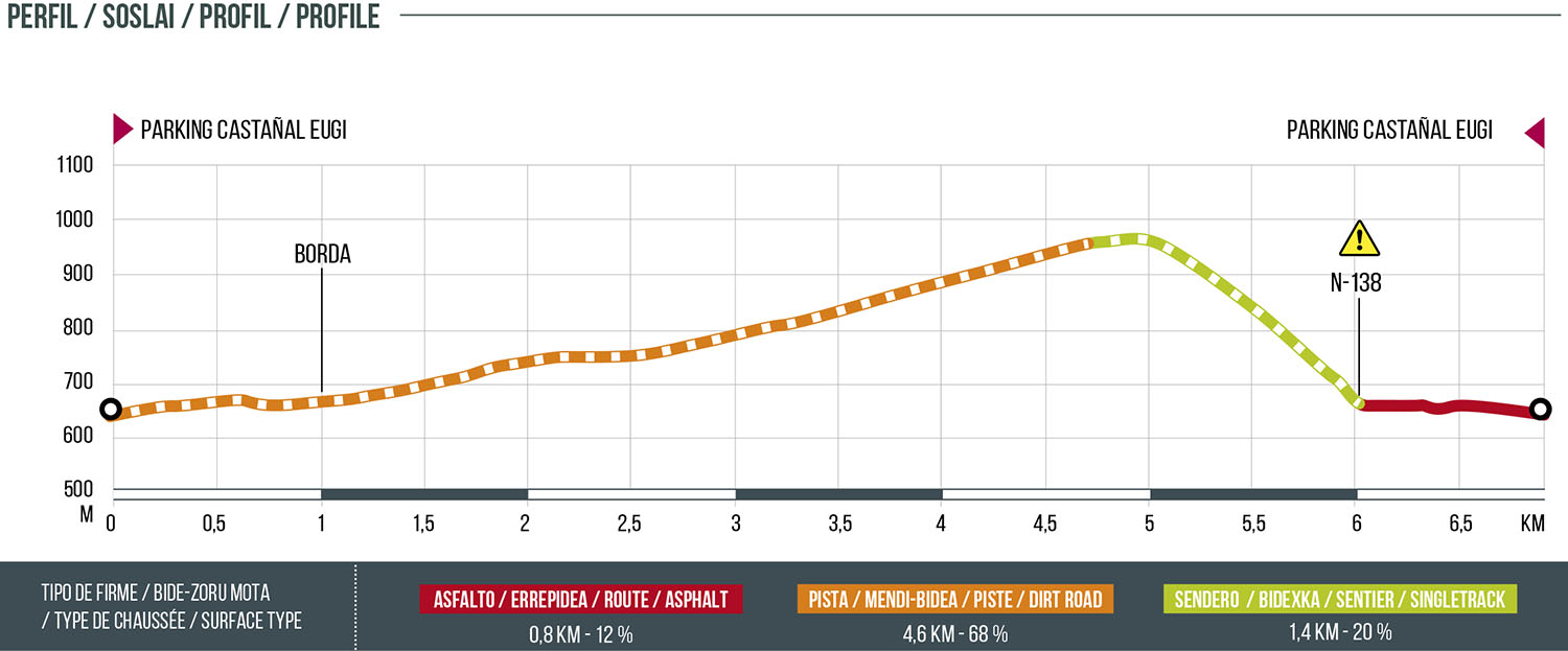
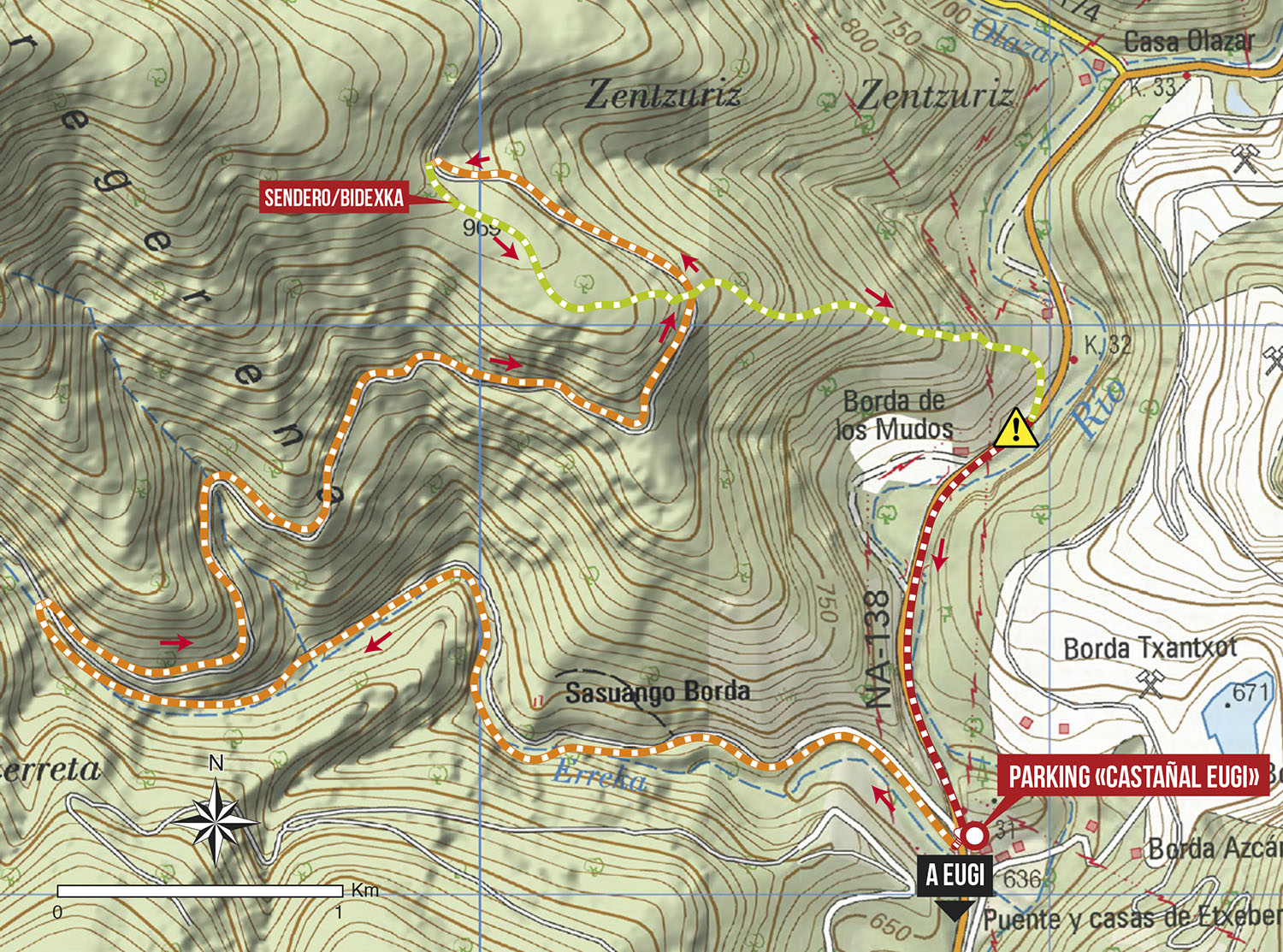
Nice route that starts from a track 200 meters from the parking of Burdindogi, going up the NA-138 road towards France. Once on this track we will gain altitude along the slopes of Mount Zuriain to begin the descent along the same path very enjoyable, in some sections quite steep. Very complete route, gaining height easily in the ascent and a direct descent to the road that we will have to take for a kilometer towards Eugi until arriving at the parking of the tail of the Eugi reservoir.
Route map
Profile