09 AZEGI ETXARRO
Distance
18 km
High
583 m
Downhill
583 m
TIme
2 – 3 h
Difficulty
Level

Wikiloc
Download trail
Track
Download track
Technical specs
Download file

09 Azegui Etxarro
Start
Zubiri
Agua
Zubiri, Eugi. Urtasun

Track description
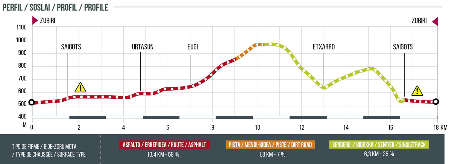
Leaving from the EREMUA center in Zubiri (Sports Center), take the NA-138 towards Eugi. Arriving in Eugi, take the track that shares the ascent with the 08. Urtasun and that connects with the pass of Gurrutxaga that connects with Zilbeti. At the pass we will go in search of the slopes of Mount Azegi. Once the routes separate, a magnificent descent begins in search of the Etxarro ravine and then a beautiful uphill path towards the antenna that is in the port of Zilbeti, where this route and the 10.Saigots join their paths. This sector of descent is coincident with the GR-225 so it is advisable to exercise extreme caution to avoid accidents with hikers.
Once we reach the road that runs parallel to the river Arga, we will cross the bridge to go in search of the road that goes up to Saigots. Once there, we will take the NA-138 road towards Zubiri. Route with two incredible descents that go through the most secret corners of Esteribar.
Route map

Profile

