20 ERREAKO BIDEA
Distance
14 km
High
460 m
Downhill
460 m
TIme
1:30 – 2 h
Difficulty
Level

Wikiloc
Download trail
Track
Download track
Technical specs
Download file
Start
Zuriain
Agua
Zuriain, Larrasoaña, Irure, Llurotz

Track description
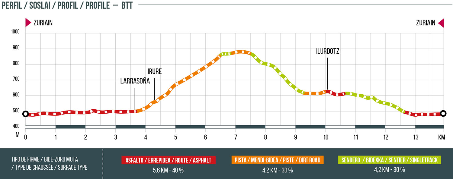
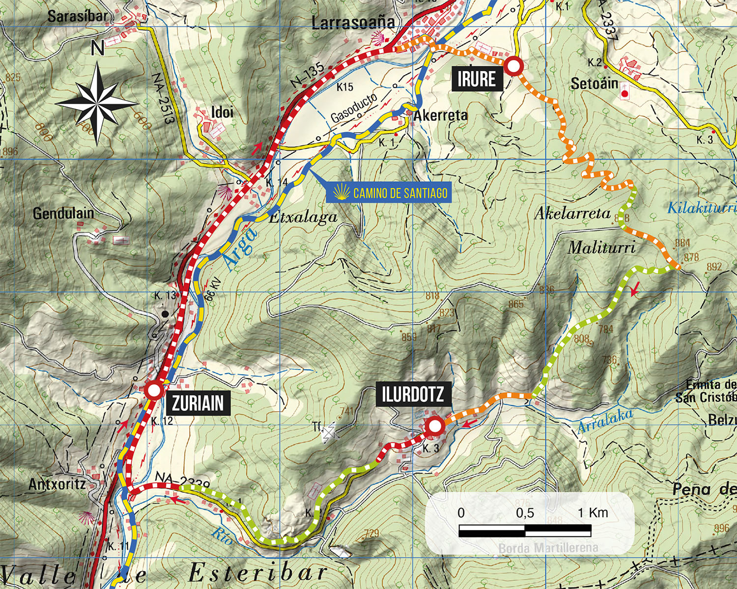
Leaving from the town of Zuriain, we will go up by road to the village of Larrasoaña, and then to the town of Irure. Already by track we will go up in direction to the mountain range that separates this town with Ilurdotz. Once there, we will go in south-east direction during 600 meters and, later we will descend by the old way of Errea. After arriving at the town and, once crossed the population, we will continue by the old way of Ilurdotz. This road leaves us at the junction with the road to Santiago, and from there we will continue a few more meters to Zuriain.
Remember that the route passes through urban areas, moderate your speed and yield to pedestrians.
Variant: if you wish to avoid the road from Zuriain to Larrasoaña, there is the option of going up the Camino de Santiago in a northerly direction. In this case, please respect the passage of pilgrims on the Camino and give them the right of way.
Route map
Profile