16 GARAZIBARKO BIDEA
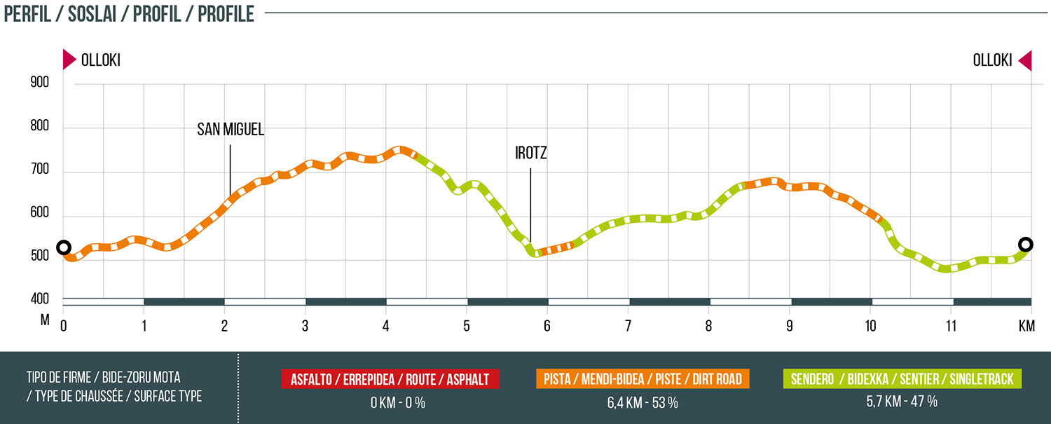
Distance
12.1 km
High
515 m
Downhill
515 m
TIme
2 – 2:30 h (trail)
1.5 h (mtb)
Difficulty
Level

Wikiloc
Download trail
Track
Download track
Technical specs
Download file
Start
Olloki
Agua
Olloki. Irotz

Track description
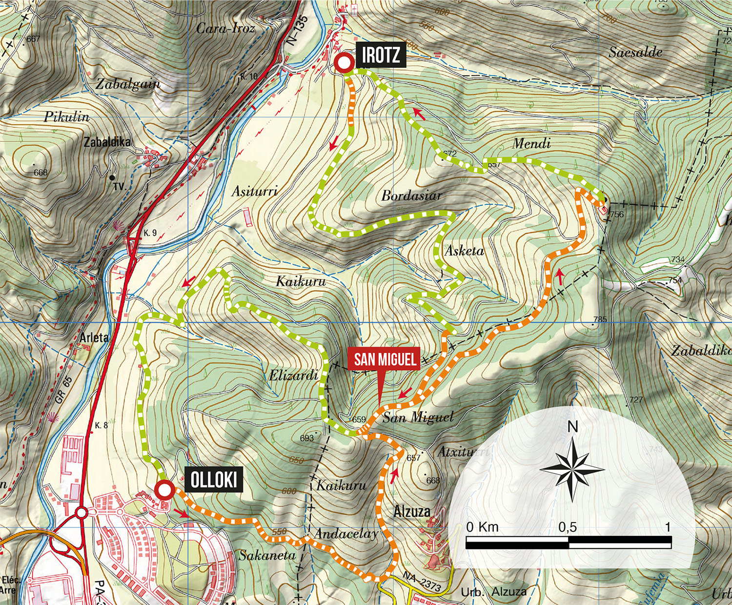
The route begins in the town of Olloki, specifically in the upper part of the village (Church). We will go up towards the San Miguel mountain through the track that goes from Olloki to Alzuza and once in the high area of the mountain, we will continue along the track that leads to the antennas above Irotz. By a nice and fast path, we will go down directly to Irotz. At the entrance of the village, we turn south to return to Olloki by an old path of Garazibar. Once at the bottom of the valley, we will go up again to the San Miguel range to connect with the downhill path that goes to the Ermita de las Nieves.
Route map
Profile