10 SAIGOTS
Distance
10.8 km
High
341 m
Downhill
341 m
TIme
1,5 – 2 h
Difficulty
Level

Wikiloc
Download trail
Track
Download track
Technical specs
Download file

10 SAIGOTS
Start
Zubiri
Agua
Zubiri, Saigots
Track description
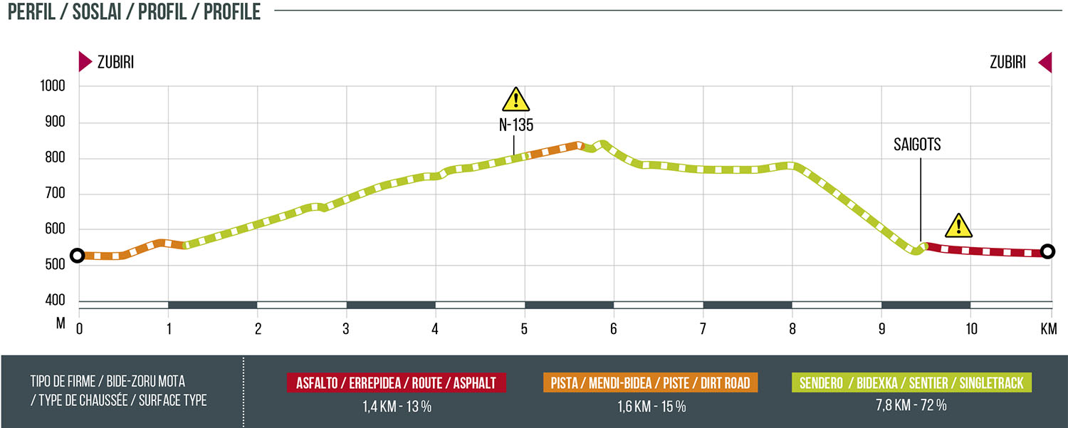
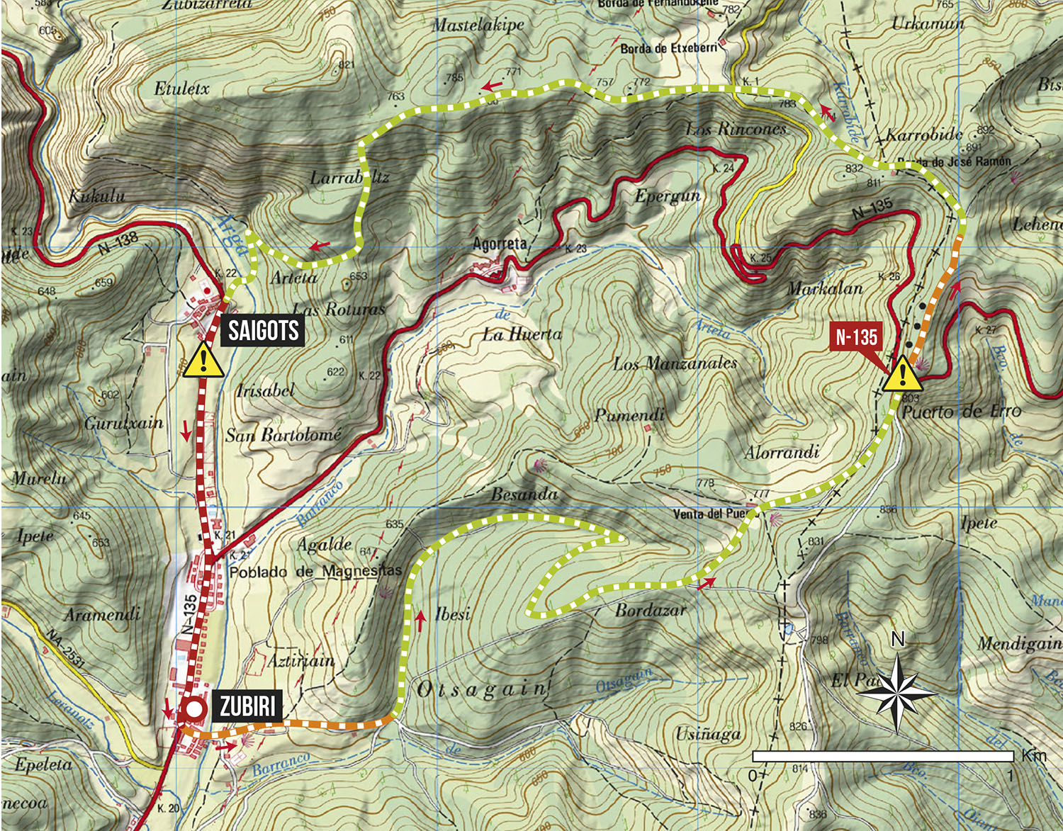
Starting from the BTT and Trail Center in Zubiri, we will leave the village by the bridge that crosses the Arga River and we will face a climb parallel to the Camino de Santiago in the direction of the Alto de Erro. Once in the Alto we will cross the road (CAUTION) and we will go along the path towards the Zilbeti pass and from there we will begin the descent that coincides with the route 09.Azegi-Etxarro-Saigots. This sector of descent coincides with the GR-225 so it is advisable to take extreme precautions to avoid accidents with hikers. Once we reach the path that runs parallel to the Arga River, we will cross the bridge to go in search of the path that goes up to Saigots. Once there, take the NA-138 road towards Zubiri.
Route map
Profile