03 coal bunkers
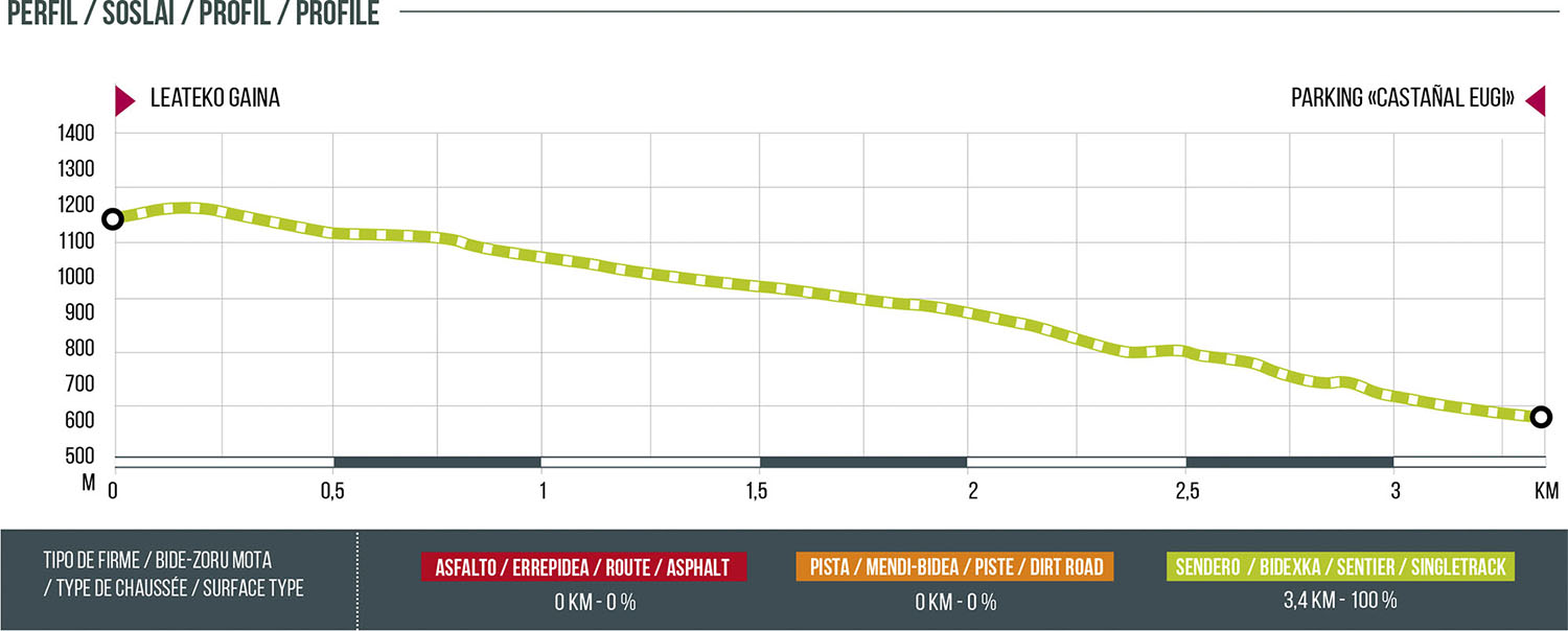
Distance
3.4 km
High
18 m
Downhill
564 m
TIme
15 – 30 min
Difficulty
Level

Wikiloc
Download trail
Track
Download track
Technical specs
Download file

03 Coal bunkers
Start
Leateco Gaina
Agua
NO
Track description
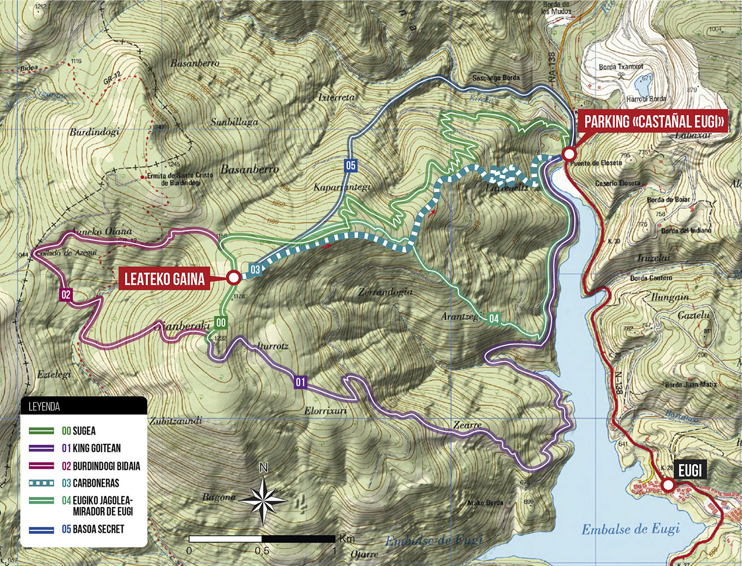
This route is the first one that was opened looking for the old paths that connected the coal bunkers that were distributed throughout the forest of Burdindogi. The route starts just before the viewpoint of Leateko Gaina and ends at the parking lot at the tail of the reservoir. Affordable route, a lot of flow and very enjoyable. The hardest steps are right at the beginning, a small trial section of 15 meters gives way to a route of real enjoyment. A CLASSIC.
Route map
Profile